 |
Geological Institute RAS |  |
|
| tel.: +7(495)230-8029, fax: +7(495)951-0443 | |||
| e-mail: gin@ginras.ru | |||
|
перейти
на русский
|
|||
FIELD-WORK AREAS
Employees of laboratory carried out the field investigations on Kamchatka,
Koryak Upland, Novosibirsk Islands, and Crimea. Besides, the materials from
South-Anui zone (Western Chukotka) and Far East were work up. The main field
areas are Kamchatka and south part of Koryak Upland.
|
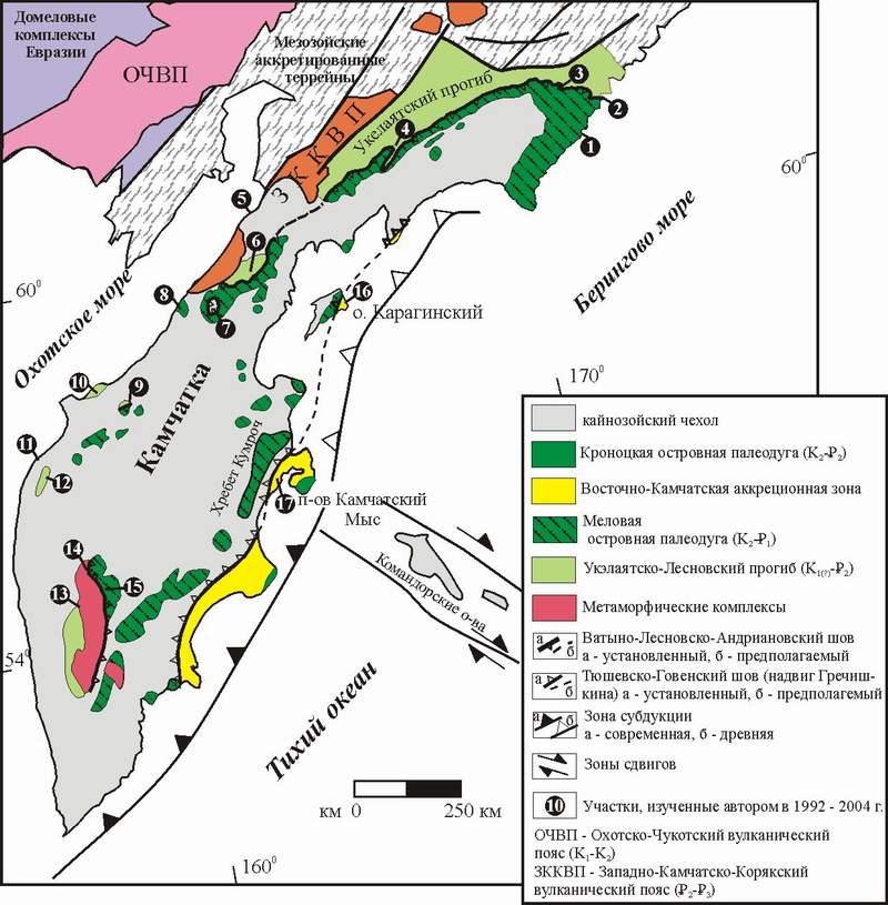
General geological setting of Kamchatka in the Russian Far East.
Numbers in black circle marks the studied locations. 1 - Cape Vitgenshtein, 2 - Anastasia Bay, 3 - Ilpi and Matysken Rivers, 4 - Tapel'vayam River, 5 - Cape Tevi, 6 - Shamanka Dome, 7 - Vatapvayam Dome, 8 - Palana River, 9 - Rassoshina River, 10 - Omgon Range, 11 - Cape Hairuzova, 12 - Moroshechnyi Range, 13 - Krutogorova River, 14 - Oblukovina River, 15 - Left Andrianovka River, 16 - Karaginskii Island, 17 - Kumroch Range.
History of field study of Kamchatka and Koryak Upland
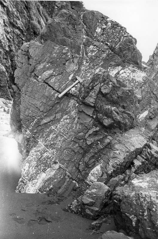
1993 - Machevna River (Olyutorskii Range, south part of Koryak Upland) (Ledneva, Soloviev, 1999[9]), Vitgenshtein Cape (Bogdanov et al., 1999; Soloviev, 1996; Kovalenko et al., 1996[6]).
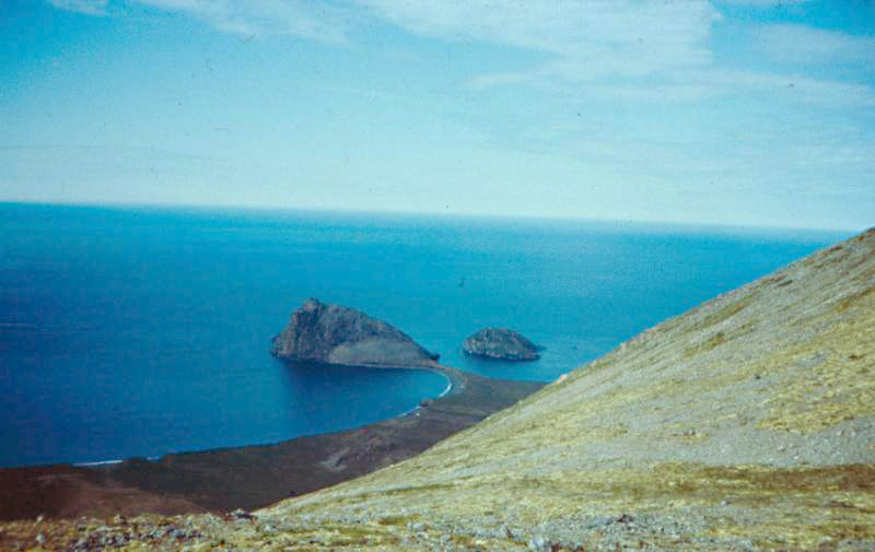 |
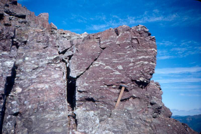
Vitgenshtein Cape
![]()
1994 - Anastasia Bay (Olyutorskii Range, south part of Koryak Upland ) (Soloviev et al., 1998; Soloviev, 1998[13])
 |
Jasper with inoceramus (Vatyna Group)
 |
Pillow-basalt (Vatyna Group)
![]()
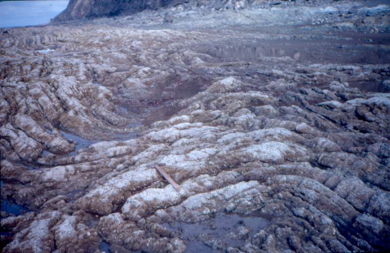
1995 - Il'pi and Matysken Rivers (south part of Koryak Upland ) (Soloviev et al., 2000; Soloviev et al., 2001)
 |
The Flysch (Ukelayat Supergroup)
 |
Vatyna-Vyvenkskyi thrust
![]()
1996 -Tapelivayam River (south part of Koryak Upland ) (Soloviev
et al., 2001).
![]()
1997 - Vatapvayam Dome (the Isthmus, Northern Kamchatka) (Shapiro,
Soloviev, 1999; Soloviev et al.,
2001).
 |
The flysch (Lesnaya Group)
 |
Chert (Irunei Group)
![]()
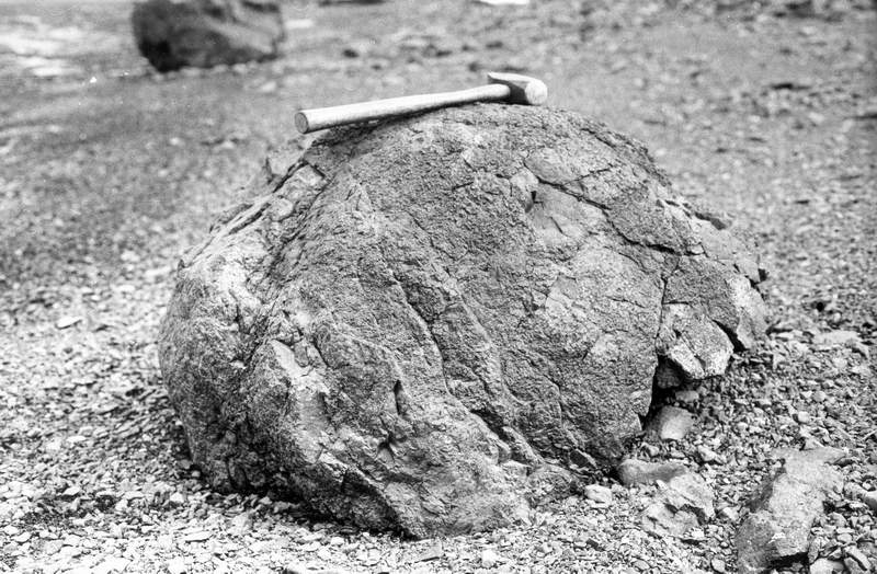
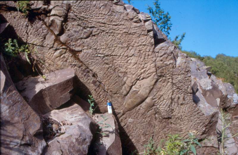
1998 - Omgon Range (Western Kamchatka) (Bogdanov et al., 2003[2];
Soloviev et al., 2005)
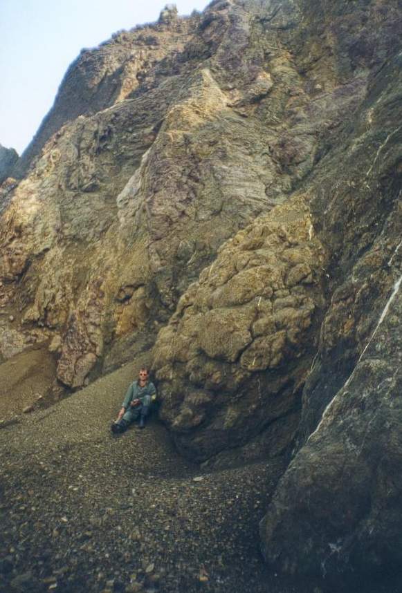 |
The tectonic block, basalts
 |
Babushkin Cape
Rassoshina River.
![]()
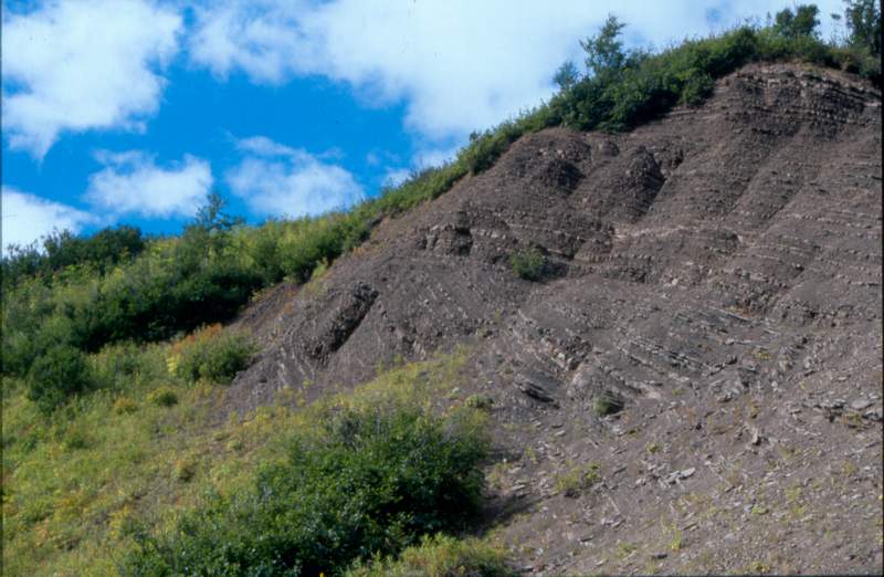
1999 - Shamankinskiy dome (the isthmus, Northern Kamchatka) (Soloviev
et al., 2001; Soloviev et al.,
2002)
 |
Folds in siliceous olistoliths, northwards of Palana River
![]()
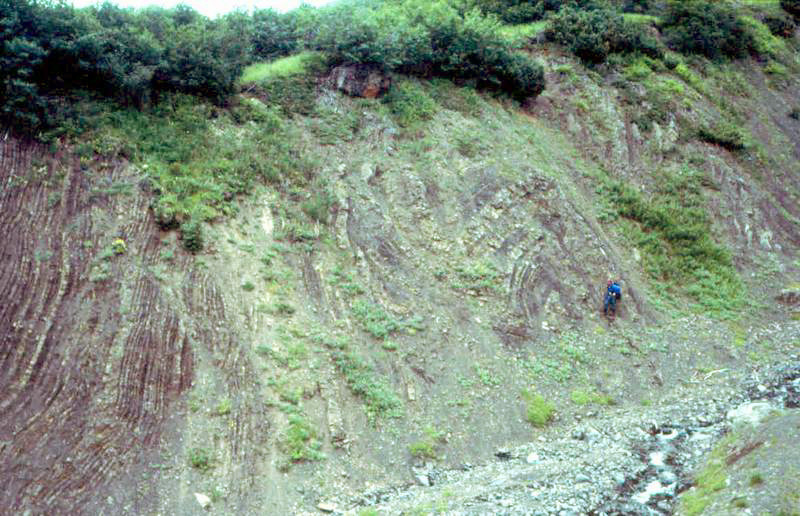
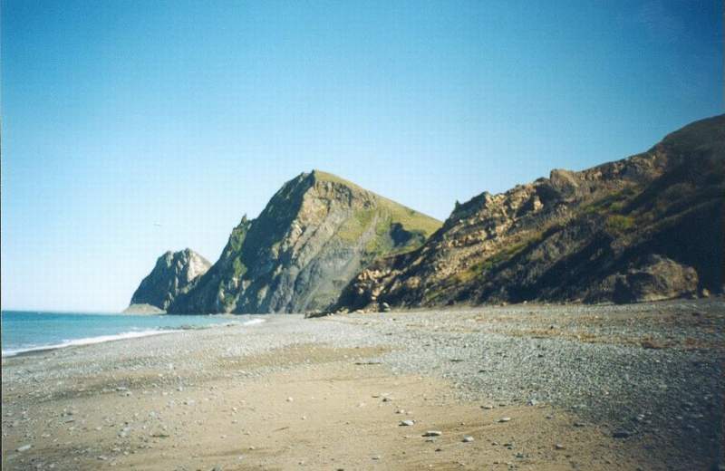
2000 - Karaginskii Island (Eastern Kamchatka) (Shapiro et al., 2004).
Hairuzova Cape, Moroshechnii Range (Western Kamchatka).
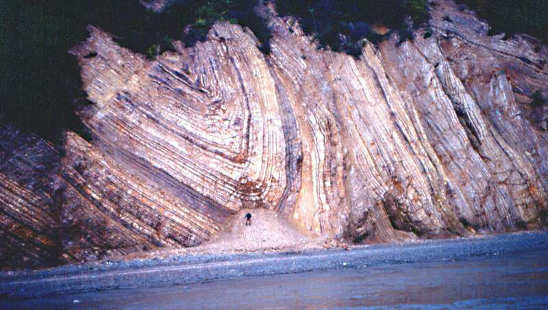 |
Folded
rocks, the Upper Oligocene - Lower Miocene, Hairuzova Cape, Western Kamchatka.
![]()
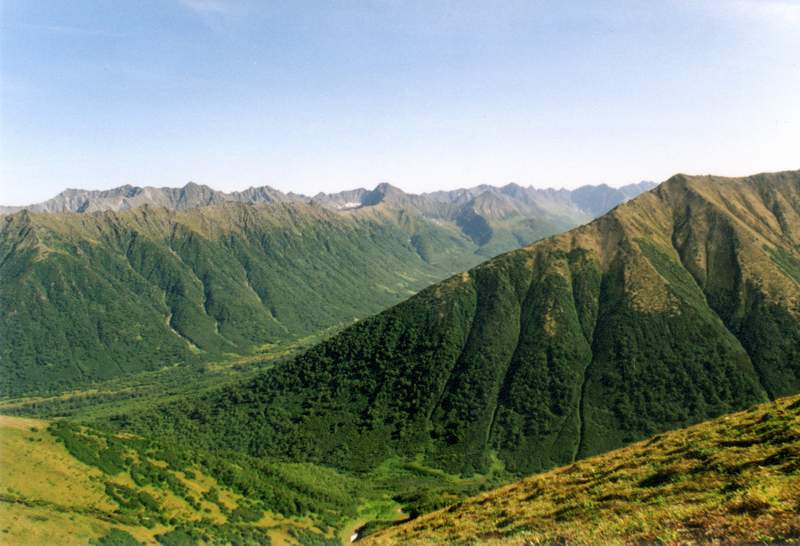
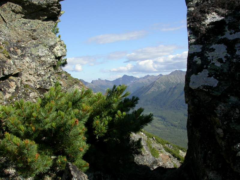
2001 - the Platonich River and Baraba Mountain area (The Sredinnyi Range, Kamchatka), (Soloviev et al., 2004).
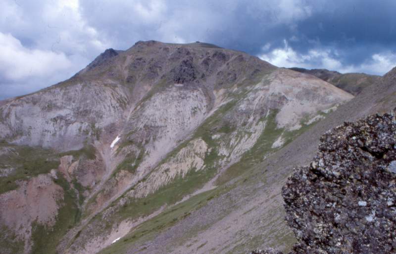 |
Baraba Mountain
The Kumroch Range and Kamchatskii Cape Peninsula (Eastern Kamchatka), (Soloviev
et al., 2004).
 |
The flysch (Drozdovka Group, the Kumroch Range)
 |
The cut-off structure in the flysch (Tushevka Basin, Eastern Kamchatka)
 |
The uplifted erosion surface (Kamchatskii Cape Peninsula)
![]()
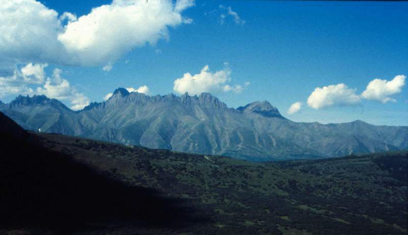
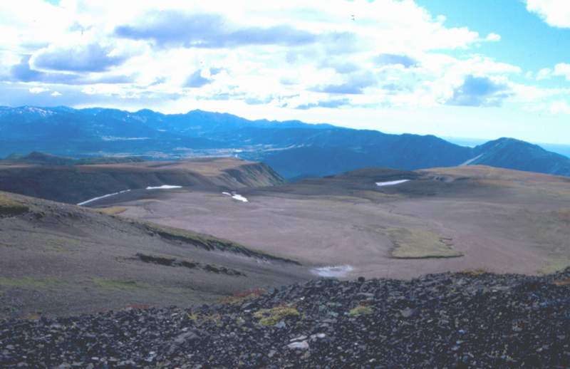
2002 - The Krutogorova River and Left Andrianovka Rive (The Sredinnyi Range,
Kamchatka) (Kirmasov et al., 2004;
Hourigan et al., 2004).
 |
The Sredinnyi Range, The Krutogorova River
 |
The Left Andrianovka River
![]()
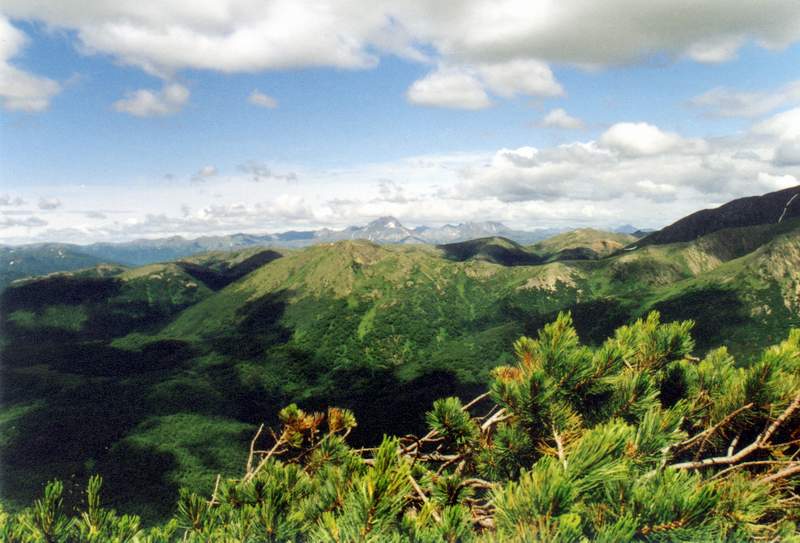
2004 - The Kolpakova River (The Sredinnyi Range, Kamchatka)
 |
The Sredinnyi Range, The Kolpakova River
![]()